Related Articles


26-12-2023
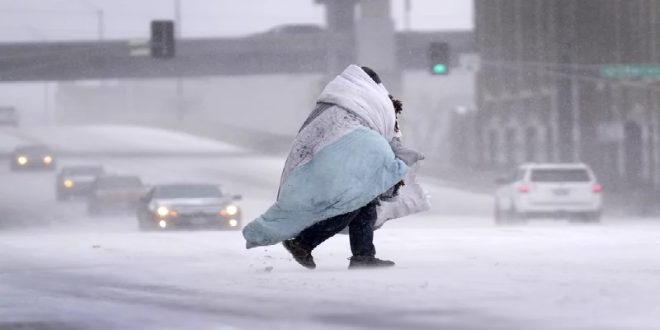
KEARNEY: Dangerous blizzard conditions from a strong storm system are snarling travel along major interstates in the central U.S. for the millions of holiday travelers hitting the road or catching a flight as the Christmas holiday comes to an end.
 A powerful storm that already caused problems for Southern California and the Desert Southwest last week, fueled by an El Niño-charged southern jet stream, has teamed up with another storm dropping out of the Pacific Northwest to create a variety of impactful weather.
While those on the warm side of the storm in the Southeast face a soaking rain and an isolated flash flood threat, the backside of the storm will bring heavy snow as a cold air mass from Canada dips into northern portions of the U.S.
Blizzard Warnings have been issued in the Plains through Wednesday as the storm brings gusty winds and blinding snow to the region.
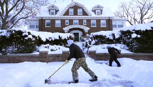
Up to a half-foot of snow had already been measured west of Denver in the Rockies of Colorado on Sunday. As much as 8 inches was recorded in Burlington, Colorado, along the state border with Kansas.
The storm has since moved northeast and created hazardous driving conditions across the northern Plains.
Nebraska State Patrol reported Interstate 80 eastbound was closed on Christmas Day at York after multiple semi-trucks wrecked in the blizzard conditions.
Near-zero visibility was reported Christmas Day on Interstate 90 in South Dakota, prompting officials to close parts of the highway between Mitchell and Rapid City. Officials said no-travel advisories for secondary roads throughout the state are also likely because of high winds, icy roads, blowing snow and low visibilities.
 “Motorists should not use secondary highways to avoid Interstate closures,” South Dakota Department of Transportation officials posted on the agency’s website. “Significantly reduced visibilities and blizzard-like conditions will make travel very dangerous during this storm system.”
Blizzard Warnings have been issued for more than a half-million people across southeastern and south-central South Dakota and central and northeastern Nebraska.
Other winter weather alerts are in effect for other portions of the region, stretching from parts of Wyoming and Colorado northeastward to portions of western and northern Kansas, Nebraska, South Dakota and North Dakota.
More rapid intensification of the low-pressure system is expected to occur over the western portion of the Midwest into Tuesday, introducing a significant threat of strong, gusty winds that will increase and expand across the north-central U.S. Blizzard conditions are most likely through Tuesday morning.
According to the National Weather Service, a snowstorm must reach the following criteria to become an official blizzard: sustained winds or frequent gusts to at least 35 mph and considerable falling and/or blowing snow that frequently reduces visibility to one-quarter mile or less, both of which must persist for a period of three hours or longer. (Int’l Monitoring Desk)