11-10-2024
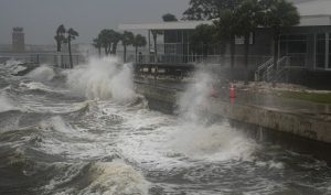
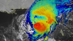
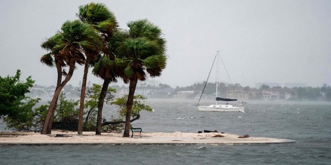
PETERSBURG, FLORIDA: An expanding Hurricane Milton made landfall on Florida’s west coast on Wednesday, spawning tornados and lashing the region with rain as it threatened the Tampa Bay area, where it could deliver a life-threatening surge of seawater.
 In a state already battered by Hurricane Helene two weeks ago, as many as two million people were ordered to evacuate, and millions more live in the projected path of the storm.
Officials issued increasingly dire warnings on Wednesday as landfall, expected on Wednesday evening, drew closer.
President Joe Biden urged people to follow local safety recommendations.
“It’s literally a matter of life and death,” Biden said at White House briefing.
Much of the southern US experienced the deadly force of Hurricane Helene less than two weeks ago as it cut a swath of devastation through Florida and several other states. Both storms are expected cause untold billions of dollars in damage.
Most hurricane fatalities occur when trees fall on people in the street, in their cars or in their homes, the National Hurricane Center warned.
Others die from post-storm accidents like setting their houses on fire using candles, igniting leaked gas with flashlights and asphyxiating from carbon monoxide produced by generators. People die of heart attacks and other medical issues after storms, as well as in accidents while using chainsaws to clear downed trees, NHC Director Michael Brennan said in a video briefing.
Fueled by unusually warm waters in the Gulf of Mexico, the storm was set to hit the Tampa Bay metropolitan area, home to more than 3 million people, as a major hurricane with a huge footprint.
The hurricane center labeled the storm “extremely dangerous.”
“On the forecast track, the center of Milton will make landfall just south of the Tampa Bay region within the next hour or two, and then move across the central part of the Florida peninsula overnight, and emerge off the east coast of
 Florida on Thursday,” the hurricane center said.
Once past Florida, it should weaken over the western Atlantic, possibly dropping below hurricane strength on Thursday night, but will nonetheless pose storm-surge danger on the state’s Atlantic coast as well.
Tropical force winds were engulfing most of the state.
While Milton slightly weakened on Wednesday afternoon to a Category 3 hurricane, the third-highest level, it was growing in size as it approached Florida and remained extremely dangerous with maximum sustained winds of 120 mph (195 kph), the hurricane center said.
The storm could bring a surge of seawater as high as nine to 13 feet (2.7 to 4 meters) in some areas and dump six to 12 inches (150 to 300 mm) of rain, with as much as 18 inches (450 mm) possible in spots. The National Weather Service confirmed at least 16 tornadoes in Florida on Wednesday, and more were expected into the early hours of Thursday.
At sea, the hurricane created waves close to 28 feet (8.5 meters) high, the National Oceanic and Atmospheric Administration (NOAA) said.
The four bridges spanning Tampa Bay were closed before the storm was due to make landfall, according to the Florida 511 website. Nearly everyone who decided to flee appeared to have done so, as most streets in nearby St. Petersburg were nearly deserted by midday on Wednesday.
Most causeways connecting the Gulf barrier islands to the mainland were also shut, stranding any who decided to ride out the storm despite pleas from officials. (Int’l News Desk)
 Pressmediaofindia


